
Coast-to-Coast in the DA40 with the G1000
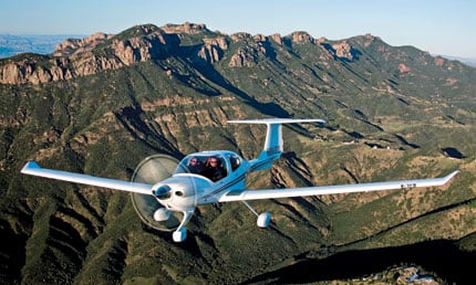
We are blessed to call so many great folks our friends, customers and supporters. Our friends Joey Richie and Matt Webb of Newport News VA just return from a great coast-to-coast flying adventure in their Diamond DA40 XLS with its G1000 panel and fuel sipping performance. This story is a fabulous example of the capabilities of our new modern aircraft. I think you’ll see clearly from their descriptions and photos the value the technology brings to making a trip like this possible. Thanks for the inspiration guys… I’m ready to launch for Catalina!
The Great Western Adventure
My partner in our DA40, Matt Webb and I just returned from a fantastic spur of the moment adventure from the East Coast (Newport News/Williamsburg) out to the West Coast in a four day trip. Matt had business in Texas and Phoenix and was looking for a good excuse to fly the Diamond out west. He asked me knowing that I can’t refuse any semi-reasonable excuse to go flying and that I could back him up with IMC situations that might arise. We synched our schedules, checked the weather for the thousandth time, then set off on Wednesday 5/26/10 knowing that we could still have two days of the Memorial Day weekend with the families if we could make it back Saturday, or at worst case we could burn Sunday and Monday waiting for weather to clear. We knew that we would be stretching the range of our usual hamburger runs and we had just ordered some seat cushions from Oregon Aero (thanks to recommendations on the DAA forum) that really came in handy.
Our first leg was 503 nm from Newport News VA (PHF) to Smyrna TN (MQY) then to Addison TX (ADS) for another 542 nm. The weather was getting unstable towards the last leg but with XM WX and ARTCC looking at the storm cells we rerouted around them and kept a healthy distance from the building cells.
The next day we set out to Roswell NM (ROW) for gas and lunch. There were no aliens to be found but the scenery over the desert was spectacular. At ROW we replanned our route because of nasty storms near Albequerque and went south towards El Paso to get around the restricted area enroute to Chandler AZ (CHD) outside of Phoenix. We had a great dinner at the “Top of the Rock” that overlooks the Phoenix skyline.
At that point, we were thinking about heading back to home base and maybe trying to catch a glimpse of the Grand Canyon when we happened to meet a fellow aviator at our hotel who was watching us scheme and plan. His advice was, “You can’t be Lewis and Clark if you almost get near the Pacific and then go home”. Well, that was enough of a friendly poke to rethink the next flight and Catalina Island (AVX) was only 2+30 away so westward ho we went to collect trinkets and souvenirs to keep the homefront pacified. The weather around southern California was beautiful and the airport at Catalina was interesting with the 1500’ drop off at either end. It felt like looking at a carrier deck again, but with no arresting wires! Socal approach was helpful in vectoring us clear of the LAX traffic too.
Out of Catalina, we headed towards Vegas and landed in Barstow-Dagget CA (DAG) in the high desert for gas. We had been reading  about flying in the Grand Canyon, and that was our next destination. The G1000 was a big help in allowing us to input lat/long user waypoints to mark the beginning and end of two of the VFR corridors. We got the chart, read up on the procedures and set off for a photo recce of the canyon. We also figured out why we were the only crazy aviators to be flying in the afternoon….the winds were high, it was hot outside and the turbulence was rough. We stayed at the corridor altitudes (11,500 and 10,500) just to have more options if we had to make an emergency landing, but the pictures came out great anyway. We bumped our way over the canyon then decided to forget the second corridor and keep heading to Albuquerque NM.
The last day was the longest flying day. We took offearly in the morning as the balloons were rising north of Albuquerque, climbed east between the mountains and over the interstate, then settled in as the terrain below turned from desert to the plains of West Texas to trees again in Oklahoma and Missouri. This leg was 724 nm and took 5+45 to get to West Plains MO (UNO) with perfect VFR conditions. We needed to stand for a while and hoped to borrow the courtesy car but alas it had just had a flat tire. But we talked to a guy in the FBO (Jack Bowman) who happened to be the airport manager for the county (Pomona MO) and he offered to take us to a nearby restaurant that had great hamburgers and local fare. Jack turned out to also be the local auctioneer, guitar player in a country band and motorcycle rider with the local club.
Out of UNO, we filed direct to Bristol TN and actually got it. That seems to never happen in our local neck of the woods. Storms in the southeast were building rapidly and ARTCC and the XM WX helped keep us to the north of the storm systems. We had a few pop up cells but we could visually stay clear and center was getting flight plan deviation requests from everybody including us. The flight from Bristol (TRI) to Newport News was at night and we got to see a picturesque red moonrise. It was a long day with 1500 nm of flying but was worth it to see the landscapes of the states we had travelled across.
A few observations we made:
1. The G1000/GFC 700 autopilot was a great help. We alternated flying each leg and exercised the knobs and buttons to the fullest on the G1000. In 36 hours of flying you have a lot of time to fiddle with every function and button on the system. SVT is a great invention.
2. We planned for an emergency landing in the desert by packing tents, sleeping bags, survival tools and water.
3. We had a backup portable gps and portable radio with lots of batteries.
4. The controllers will generally work with you if you are prepared and considerate of them. Diverting left and right of course to get around cells was never a problem and several controllers offered different routing to bypass storm cells. The XM WX was generally agreeing to what the controllers were painting on their radar. We realized the satellite picture was dated but it did provide a strategic picture.
5. There are some real characters at the airports and places we visited. Talking with those folks really made the trip.
6. After flying a long leg (anything approaching 4+00) we made a pact to go get something to eat and be away from the plane for at least an hour.
7. The next time, we want to stay for a while in some of the places we landed and see more of the towns, attractions and friends. This was a good trail blazer. Now we have no excuses for that DAA fly-in in Utah!
8. The calculated fuel burn was a couple of gallons higher than the actual fuel burn. The fuel gages were dead on accurate.
9. I’d do it again! (But I need a few days to recover).